Evolution of the Site
About Us
Safariing
Travelling
Accommodation
Equipment & Gadgets
Souvenirs
Clothing
Safari Activities
Coastal Activities
Security
Health
Where
When
Experiences
Slideshows
Evolution
Contacts
Site Map
Sub Site
The site and applications were developed while working full time, for instance in 1996 I was a salesman working 5 days a week and catching-up on paperwork on Sundays. As a part time developer it is difficult to keep pace with changing technology, such as Windows (in all its forms - I started with DOS, the last manual I read was Windows 3.1, through Windows XP, a bit of Win2000, quickly moving through Windows 7 to Windows 10) and Visual Basic through to V6. When Microsoft in their wisdom dropped support for Visual Basic I then tried a mix of HTML, javascript, java and Python. So this shows the eclectic mix of the tools used through time. |
||
Posters |
 |
|
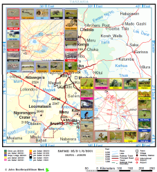
Initially I started by producing posters (until c. 2003), with a map as a background and small photos of animals in roughly the right location, as best I could remember. (I have a good memory for locations, often recalling where we had seen animals many years before). |
||
Digital Camera |
||
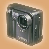 |
In 1998 I invested in a digital camera - the Sony Mavica FD7 with x10 zoom lens. It would take about 25 640x480 photos and save them to a 3½" floppy disk. Each file was about 25k but didn't need scanning or processing, as Alison's Pentax photos did - and then she threw a good 75% away. |
|
Web-site |
||
By 2000 I began publishing my web-site, East Africa Dreams (Kenya Dreams had already been taken). I originally selected a poor hosting site, so got off on the wrong foot. When I had enough of them I sent a detailed enquiry to other hosting services about where their servers were, peering arrangements etc and the only company to respond professionally were KT Hosting. Their service has been excellent ever since with only a few outages, which were resolved in hours. I remain with them today. |
 |
|
Slideshows |
||
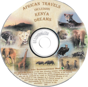 |
About the same time I started creating my own slideshows. |
|
GPS Logger |
||
In 2004 I found with the backlog of work and failing memory, I couldn't remember the locations accurately enough. So I invested in a Pretec GPS logger to track our locations. To interface with it while we were away I needed a personal assistant and some relevant software, which was provided by HP's iPaq. |
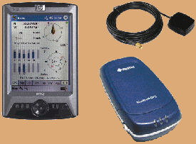 |
|
Initially I manually time syncing the camera with the GPS logger and reading the EXIF time stamp (as well as other details, such as FL which with the chip size can give the FoV) photo positions can be almost as accurate as GPS - say 5m. In reality unlike GPS (which relies almost exclusively on time for position) the camera clock drifts and even with multiple syncs, on a safari gives an error of a couple of seconds. When safari-ing this usually isn't significant as we are stationary when taking pictures and travel at 25-30 mph otherwise. But on the train when we could be travelling at 70 mph or more could give an error of 50m or so. Shortly after I learnt to take a photo of the GPS screen & tied the time together with the photo's EXIF data which produced a mch more accurate time sync/positions. |
||
Google Earth |
||
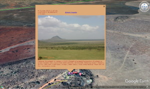
In 2007 I began using Google Earth screenshots and calibrating them for use with my personal organiser, so I could track in real-time. |
 |
|
Raspberry Pi |
||
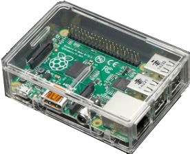 |
In 2016 I bought a Raspberry Pi, which allowed me to start hosting my own services. (The cost of hosting a site with large storage was beyond my means as a hobbyist). |
|
Photobooks |
||
These printed maps came to the fore when I began creating printed photobooks, where the resolution had to be higher. |
 |
|